HANDIES PEAK, CO ~ September 2, 2007
 Since we were camping in the American Basin with tall peaks all around, the sun didn't reach us until 8:30 am. It was 41º
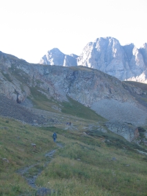
I had thought we’d all get at least part way up the trail and perhaps some of us would have to turn back after a while. But when it came time to head out, Josh felt sick and Jon didn't feel good either. I was disappointed that I had to stay down with them and wasn't even able to say that I had attempted to reach the top. Even so, I understood because when I was younger I used to get headachy and nauseous just going up to the higher elevation of
I had brought along ginger cookies and ginger candies, but the kid who should have been eating them didn't like the way they tasted. So Josh kept throwing up all morning, until around noon he finally felt better and we walked along the stream to a waterfall. Jon wasn't too bad, perhaps because of the motion sickness wrist bands he was wearing, but he just wanted to stay in the car and snooze. We were parked near the site of an old mine, although all that was left of this one were some tailings.
 Even though we had to wait while Rich and Pete were gone for six hours, the time didn't seem that long. I got the car organized, looked at the map, and watched people come and go. A few climbers had gotten there even before us, but the majority of them came between 9:30-10:00 am. A few others didn't start out till the afternoon. Some people just drove up the
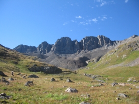
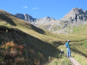
It was funny, Rich and Pete departed from the trailhead at 7:30 am. We were still freezing and bundled up. But at the same time, a group of college girls started up the trail and they were all wearing shorts! The girls were already back down at 11:00 but Pete and Rich didn't return until 1:30. I thought maybe the girls hadn't gone all the way to the top of the peak, but Rich rolled his eyes and said that they had indeed been at the top. People who live in
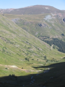
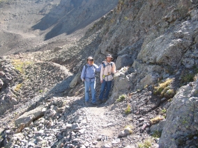
Along the way to Handies Peak, Rich and Pete passed by
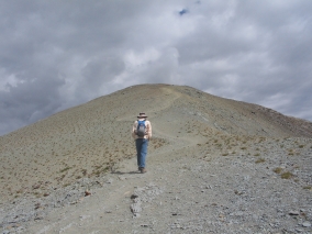
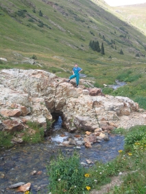
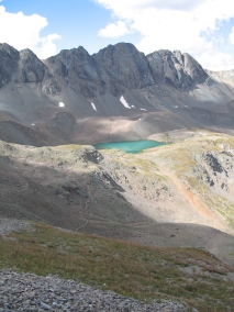
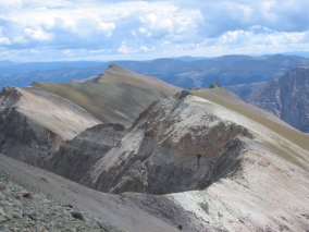
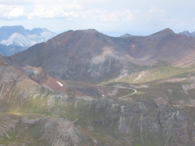
Rich and Pete made it to the top of Handies, so I was glad of that because the whole reason why we had come here in the first place was because of Rich's wish to climb a 14,000 foot peak. Rich and Pete thought they were on a false peak until a guy came by and told them that was THE peak. Rich said the trail had swung around so they must have been close up above us but couldn’t see us. It was like being in the middle of a primitive wilderness, because all they could see were mountains for miles around. Fortunately they took lots of pictures so that I could see what they saw.
According to their GPS, the trail was 2.5 miles long each way. The elevation gain was about 2600 ft. They started out at 7:30 am, reached the summit at 11:30 am, and got back down at 1:30 pm. At 14,048 feet, Handies Peak is among five other 14,000 foot peaks in the area (Sunshine Peak, Redcloud Peak, Uncompahgre Peak, Wetterhorn Peak, and Mount Sneffels), as well as numerous high thirteeners. Rich said that the panoramic view from the top looking out over the
The road to
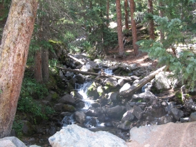
Even the streams and waterfalls in the highly mineralized San Juan Mountains have a silvery appearance.
Additional Information:
http://www.co.blm.gov/gra/gra-american.htm (American Basin
Labels: Alpine Loop, American Basin, Colorado, Handies Peak, mountain climb, San Juan Mountains
posted by Teri @ 10:10 AM
0 comments
![]()
![]()